The intensive development of day-to-day technology in the field of expanded reality enables more and more ways to present products and services to potential customers. In the crowded and average saturated market, it is necessary to create an added value of the product that will allow it to initially differentiate from the competition, delighting at first glance.
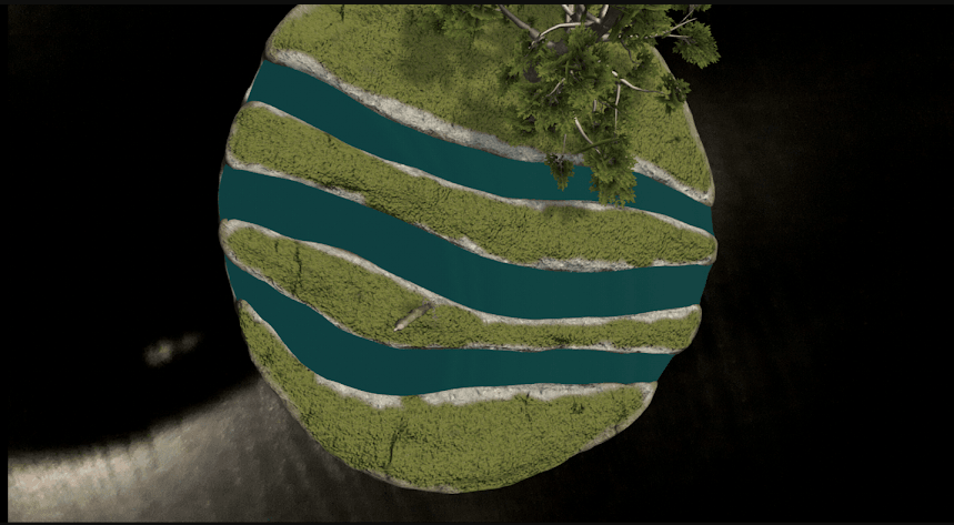
Reflecting on the future of marketing and presentation, Culex studio for the Vukovar-Srijem County Tourist Community is developing VSŽ AR, an ideal tool for an excellent first impression. The VSŽ AR application by scanning the coat of arms of the Vukovar-Srijem County from any surface creates an animated 3D model of all the elements that the logo contains (wood , creek, deer). The model can be rotated, enlarged and reduced in 3D space, according to the wishes and needs of the users.
Picture 1. 3D model of Vukovar-Srijem County The additional content of the application consists of an interactive 3D map of Vukovar-Srijem County with the cities of Vukovar, Vinkovci, Ilok, Županja and Otok. By clicking on a city-specific app, the app shows the city’s symbols and the basic information about the city for Users.
Picture 2. Old football ball – the symbol of the Parish of the ARW is made on the Google ARCore Reality Building. ARCore enables mobile devices to “feel” the environment, understand the world and interact with feedback.
ARCore technology integrates virtual content into the real world using three variables received from a camera device:
Motion Detection – Allows the device to understand its position in relation to the environment.
An environmental analysis – Allows you to detect the size and location of horizontal, vertical and inclined surfaces such as floors, table walls, etc.
Quantity light – enables the detection of light conditions in the areaAs a basis, ARCore technology is based on two variables: tracking device movement through space and learning about the environment.
Using the camera, ARcore finds “interesting” points in space and analyzes their movement at a certain time. By combining the measured variables and those of the internal device sensors, it determines the orientation and position of the device as it moves through space. Inside space then finds straight surfaces and calculates their illumination. After calculating variables from the environment, ARCore allows the insertion of virtual elements into the space as well as further interaction of space, users and virtual elements.
ARCore technology supports most devices with the operating system Android 7.0 (Nougat) and newer. You can find a list of all supported devices here.


Follow us: